No, this is not the same Moab that was an ancient nation located in the uplands of the Dead Sea, (now part of Jordan).
That area was unprotected from the east; hence its history is a chain of raids by the Bedouins. The Moabites were close kin to the Hebrews, and the language of the Moabite stone is practically the same as biblical Hebrew. The relations of Moab with Judah and Israel are continually mentioned in the Bible. As a political entity, Moab came to an end after the invasion (c.733 B.C.) of Tiglath-pileser III.
Its people were later absorbed by the Nabataeans. The Moabite religion was much like that of Canaan. Archaeological exploration in Moab has shown that settlements first occurred in the 13th cent. B.C., but what in the heck does “all of that” have to do with this post? Well actually… nothing. They just happen to have the same rather unique name.
Even though that is NOT the Moab we are discussing here in this post and although maybe even without some of the long Biblical history of the Mideast, it is however still a pretty cool place. Well, now that I think about it, the weather is not too unlike the weather that you might find in the Mideast as well especially in the summer.
When you start discussing the history this particular Moab you’d need to move past that Mid-Eastern Moab by some 1,500 years or so just for the starting point of this Moab in Utah. Because this Moab (in Utah) has a history that basically starts just prior to the construction of the railroad in 1883. Moab, Utah at that time was primarily known as a strategic place to cross the Colorado River.
A toll ferry service across the river ended when a permanent bridge was built in 1911. This particular bridge was replaced with the current bridge in 1955. The highway that uses this bridge has been renumbered multiple times and is presently numbered U.S. Route 191.
Moab gained freight railroad access in 1962, when a spur railroad line (now the Union Pacific Railroad's Cane Creek Subdivision) was built to service the Cane Creek potash mine. Moab has never had passenger rail service, although the California Zephyr has advertised service to Moab in the past via the stops at Thompson Springs (no longer a scheduled stop), Green River or Grand Junction, Colorado.
Moab currently does not have regular bus service, although charter busses and shuttle service to Salt Lake City or Grand Junction in Colorado are available most times during the year.
In 1949 the famed Western movie director John Ford was talked into using the area for the movie Wagon Master. Ford had been using the area in Monument Valley around Mexican Hat, Utah, south of Moab, since he filmed Stagecoach there 10 years earlier in 1939. A local Moab rancher went, found Ford, and persuaded him to come take a look at Moab.
There have been numerous movies filmed in the area ever since, primarily using the beauty of Arches National Park and Canyonlands National Park as their backdrops. Since the 1970s tourism has played an increasing role in the local economy of Moab.
In fact Mrs. LZ stayed in a place called the
Moab Valley Inn which when we checked in had all sorts of pictures of the movie stars, cast ands crews of some of the movies that were made using Moab as it base of operations. I happened to notice that one of the movies was called
“Road To Redemption” and after we got home we rented this movie just to see if we recognized any of the Moab locations in the movie. Many of them happened to be scenes that we actually remembered seeing while we were in and around town.
If you are perhaps wondering what other movies have been filmed in and around Moab, here’s a short list of some films:
Rio Grande (1950),
Warlock (1958),
The Comancheros (1961),
Cheyenne Autumn (1963),
The Greatest Story Ever Told (1963),
Once Upon a Time in the West (1968),
Indiana Jones and the Last Crusade (1988),
Thelma and Louise (1990),
City Slickers II (1994),
Baraka (1992),
RocketMan (1997) and
Mission: Impossible II (2000).
For all of you Star War junkies, you may be interested to know that the course for the pod races in
Star Wars Episode I: The Phantom Menace (1999) is a computer-generated imagery montage of Moab area landmarks, including Angel Arch.
Partly due to the John Ford movies, this area has become a favorite for photographers not unlike myself, as well as rafters, hikers, and most recently mountain bikers. Moab is also an increasingly popular destination for four-wheelers as well as for BASE jumpers, who are allowed to practice their sport in certain areas around Moab.
In recent years Moab has seen a surge of second-home owners too. The relatively mild winters and enjoyable summers have attracted many to build throughout the area. Controversy has arisen over these new temporary citizens and their homes which remain unoccupied through most of the year. Many citizens in Moab are concerned that Moab may soon become like Vail or Aspen in Colorado, which I guess they don’t care for too much according to their comments. Sunset magazine's March 2009 issue listed Moab as one of the 20 best small towns in the west. Although Mrs. LZ and I really had no desire to start building a second home here, it was still a very nice place and the people their seemed genuinely friendly and hospitable.
Riding along the road not far from the city of Moab is where I happened to catch this picture of the
“Hole In The Rock” sign actually written on the red rocks. I laughed when I first saw it, but then the more I though about it, the less funny it seemed to me. I quickly thought to myself something like… if that was in a National Park it would be about the worst graffiti I had ever seen, but I guess on private property it would be called advertising? And it looked as though some entrepreneur was hard at work there.
"Treat the earth well: it was not given to you by your parents, it was loaned to you by your children. We do not inherit the Earth from our Ancestors, we borrow it from our Children." ~ Ancient Indian Proverb


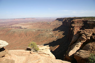
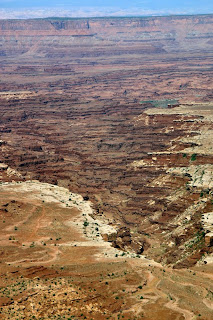
 As we still find ourselves moving backwards in our adventure, the next step is also another National Park to cross off of my bucket list. Additionally, it was also one that I knew almost nothing about, but at first glance, it looked very much like a smaller version of the Grand Canyon to me. Which, if I really think about it… could be the reason that it has the name that it does too?


