home  
Much LAZIER than your average blogger  
  LZ's info | past | photos
1.31.2008 - 26 comments 

I had to make just one more post before leaving this charming city. The city of Burlington is both a “National Trust for Historic Preservation” town, but also a recipient of the “Great American Main Street” Award too. They even had this beautiful bridge called the Great River Bridge on U.S. Highway 34 that went directly over the Mississippi River and right into the city of Gulfport, Illinois. We did not do this drive that day, but we did do it the next day as we drove over the Mississippi and on down through Southern Illinois.

After we had our fun on the "Snake Alley" road trip we went down and checked out the river front area and got some directions for finding a place to have diner. When we asked to locals what we should see while we were in their lovely little town, that answer was always the same; “Have you seen Snake Alley?” So I would say that in spite of it NOT being the most publicized crookedest street in the world, it is still the # 1 tourist activity in Burlington, Iowa.

One thing that no one pointed out was this once beautiful church, that back in April 2007 was destroyed by fire. Newpaper reports said; "The First Methodist Church at 421 Washington Street in Burlington was destroyed by fire early this morning. Burlington and West Burlington Fire Departments were called to fight the blaze."

Burlington Fire Marshal, Mark Crooks said, “Per-Mar Security notified the Burlington dispatch center at 2:41 this morning of an automatic fire alarm going off inside the First United Methodist Church.” “Firefighters arrived about 4-minutes later and they found heavy fire in basement and on the first floor on the north side." “Master streams were set up right away and there are still some hotspots in there right now.”

“The State Fire Marshal’s office has been notified as well as the BATF from the federal government and they’re on the way down here right now. We’ll be making a determination about where we go from here." “It’s definitely suspicious at this point in time and we’re going to be continuing our investigation.”

The only fortunate part was that no one was hurt. But all I could see was the terrible damage that was done to this once glorious building. I tried to find out about the history of the building but was not really able to find out too much about it.

I did find out a little more about the city of Burlington though. It is the county seat of Des Moines County, Iowa. Burlington is the center of a micropolitan area including West Burlington and Middletown, Iowa and Gulf Port, Illinois. And that it has been called the Backhoe Capital of the World. (Whatever in the world that means)? My guess... that must be a farm tool that is made around here somewhere?

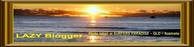
Later that day, (from a local's suggestion) we had dinner in a place called Big Muddy’s on the Mississippi. This was right in downtown Burlington on Front Street on the shores of the Mississippi. Additionally from our table, the place had a really great view of the pretty Great River Bridge. The view of the bridge from our vantage point in Big Muddy's, was much the same as this shot I took on the left. I personally thought the bridge looked much better lit up at night, than it did in the sunlight. But I also have another picture of the bridge from the other side in the daylight down below.

Big Muddy’s was actually an adaptive reuse of the old 1898 Burlington, Cedar Rapids and Northern Railroad freight house, which was turned into a restaurant and bar complete with a dock for boaters and parking for cars. When we got there, the place was very noisy and busy, but by the time we had completed dinner, the place had slowed down its business and gave us a chance to just relax for the evening before making out way back to our hotel.

Even though the first picture on the bottom doesn't do much to really sho the character of the place, we really did enjoy our dinner there with our view of the bridge. As we sat there having dinner, I also thought of the Golden Gate Bridge back in San Francisco compared to the Great River Bridge and the Lombard Street expirence compared to the Snake Alley expirence and Lombard Street and I could not help but see similarities between both bridges and between both the street and the alley. Starkly differnt but yet both quite unique.

One of the things I got a kick out of at Big Muddy’s was where they had painted high water lines inside the place that mark the last big flood where the banks of the Mississippi had overflowed into the building. All I could think off when I saw those was, I am sure glad we weren’t here “THAT NIGHT!” Timing is everything!

"The Mississippi River will always have its own way; no engineering skill can persuade it to do otherwise..." ~ Mark Twain in Eruption


1.25.2008 - 55 comments 

Several of you may remember when we were in San Francisco a few months ago and my post about "Lombard Street" (often referred to) as the crookedest Street in the World. But you may also remember that although I said it really WASN'T actually the crookedest street in the world, I failed to say what WAS the ACTUAL crookedest street. At that particular time, I didn't really know what it was, or even WHERE it really was for that matter. I then had a blog commenter post the question, "OK… well what IS the real crookedest Street in the World then?"

I did some research and then updated my blog post to include the information that it was (according to) what "Ripley's Believe It Or Not" calls the "Crookedest Street in the World." It is “Snake Alley”! Since that time, I have actually had a desire to visit this place, which I had previously to this never heard of before.

As we kept on going on our trip at the end of this summer to the Eastern side of Iowa, we decided that we were actually going to try and find this place and go at least get some pictures of it and if possible, drive down it too. So we made reservations and took off on a quest to find this place. After arriving in Burlington, Iowa, we actually found highway signs that pointed the way to “Snake Alley”. After driving around for a while we finally came across the exit of it. We parked the car and started our “Crooked Street” adventure.

It is located between Washington and Columbia Streets on Sixth Street in this quaint little town of Burlington. This Mississippi River town is in the Southeast corner of Iowa actually not too far from where Iowa, Missouri and Illinois meet on the Mississippi. Even if we had not gotten there just to see Snake Alley, it would have still been a nice town visit.

When we got to Snake Alley, we drove to the bottom of it to get some pictures and then walked to the top of it and took some more pictures. While at the top, we found out that you can actually drive down the (one-way) street, just like you can on Lombard Street. It is not like the queues at Lombard Street, where you sometimes have to wait for quite a while before you can get in line to go down the street.

I did also test my driving skills on what is perhaps Burlington's most famous landmark, Snake Alley. It consists of five half-curves and two quarter-curves and drops 58 feet over a distance of 275 feet. The street is reminiscent of vineyard paths in France and Germany.

The thing that was most intriguing to me, were the bricks that were laid on angles so that the horses that pulled the milk delivery trucks to the top of the hill could get more traction while climbing up the hill. For me, that was the most remarkable part of the whole street. It was actually both longer and more crooked than Lombard Street, but as you can see (from the pictures below), nowhere as beautifully landscaped.

Snake Alley was actually constructed in 1894 as an experimental street design. The intention was to provide a more direct link between the downtown business district and the neighborhood shopping area located up the hill on North Sixth Street. Working together, three public-spirited German immigrants conceived and carried out the idea of a winding hillside street, reminiscent of vineyard paths in France and Germany. Charles Starker was a German-trained architect and landscape engineer who settled in Burlington partly because it reminded him of southern Germany. He took a prominent role in many of Burlington's development projects, including Crapo Park, which was built at the same time as Snake Alley.

William Steyh, the city engineer, was well respected for his engineering capabilities and his enthusiasm for park projects. Steyh was also involved in developing Crapo Park, as well as the street railways and stone viaduct construction.

George Kriechbaum, a paving contractor, was a Burlington pioneer whose parents had emigrated from Germany. He constructed the first brick paving in Burlington in 1887. The brick paving of Snake Alley is still the original brick that Kriechbaum provided in 1894. This fact just amazed me as I viewed how well this street still looks after 113 years of use.

Local newspapers proclaimed the street "a triumph in practical engineering." The city had considered constructing more streets in this same manner, but the switchback design proved to be less successful for horse carriages than the city had anticipated.

There is a legend that the fire department used this alley to test horses. If a horse could take the curves at a gallop and still be breathing when it reached the top, it was deemed fit to haul the city's fire wagons. Unfortunately, many teams would run out of control or stumble over the limestone curbing, sometimes resulting in a broken leg.

The alley is composed of tooled, curved limestone curbing and locally-fired blue clay bricks. The constantly changing slant from one curve to the next necessitated a complicated construction technique to keep the high grade to the outside. The craftsmanship and soundness of materials used in the construction of Snake Alley have made it a durable street. It stands today as a singular landmark in Burlington and a reflection of the city's ethnic heritage.

Although this certainly did not have all of the glit and hype of Lombard Street, it sure was nice and quiet around there. Everyone was very pleasant and the view of the Mississippi and the city was in ways just as magnificant from the top of Snake Alley as it was from the top of Lombard Street. But... just in case someone should ever ask you which is older Snake Alley or Lombard Street. The answer is that Snake Alley wins that one too. Lomard Street came about in 1923 as opposed to Snake Alley that was started in 1894 some 29 years earlier than did San Francisco's Lomard Street.

“Be wary of technology; it is often merely an improved means to an unimproved end.” ~ Henry David Thoreau


1.19.2008 - 18 comments 

Continuing along our eastwardly path through Iowa along Interstate 80 (and on through) the Iowa state capital city of Des Moines, we veered off of the Interstate and on to highway 163 toward that wonderful little town of Pella, Iowa where you may (or may not) remember I did a post about several months ago.

Sometimes in life, you find places that you didn't even know you were looking for. This occasion was exactly one of those for Mrs. LZ and I. As you can see from the attached pictures, this was just a wonderfully beautiful and serene little place that was just a couple of miles off of the beaten path.

A tall, wooded ridge is the most prominent natural feature of this 175-acre park south of Mitchellville. Thomas Mitchell, a native of New Hampshire, built his cabin here along Camp Creek in 1844. His cabin site is no longer visible, but Polk County's first permanent English-speaking settler is still remembered by a park monument and the town of Mitchellville which bears his name.

I was really quite taken by this tree stump that they had turned into a piece of park art. As you can see from the picture, Mrs. LZ (while being shy) loved this giant acorn too. The park which seemed almost abandoned had all sorts of camping areas.

It offered a 49-unit campground, two picnic shelters, universally designed play area, fishing pond, and the 1-1/2 mile Devotie Trail. The park entrance is located on NE 108th Street just south of NE 46th Street between Altoona and Mitchellville.

Thomas Mitchell Park was named after Polk County’s earliest Anglo-American settler, Thomas Mitchell. In 1844, Mitchell obtained early access to the Iowa Territory from Captain Allen, commander of Fort Des Moines. In exchange, Mitchell built a bridge over Camp Creek which was often impassible to wagons traveling from Keokuk and Iowa City to Fort Des Moines. He also built the Apple Grove Inn, in what is today’s Thomas Mitchell Park. Thomas Mitchell was not only an innkeeper, but also a farmer, legislator, sheriff, and operator of a stop on the Underground Railroad.

I loved the little red bridge that took us from the park into a wooded path that was frankly like spending a day in the woods. We (as we usually do) had a picnic lunch packed just in case we found a place just like this one in order to stop and have a relaxing lunch while traveling along. You may notice that there was no one else around in this park. We virtually had this part of the park all to ourselves.

Often times, that is a more special stop than our stated destination. And although I can't say that was exactly the case with this particular day, this park was one of the most peaceful and frankly isolated ones we have been to in a long time. I could not help but think how lucky the folks in Des Moines and Mitchellville were to have such a wonderful little park like this one so close to them. If you ever happen to be close to Des Moines, Iowa may you please let me suggest you bring a picnic lunch?

I only went out for a walk and finally concluded to stay out till sundown, for going out, I found, was really going in.
~ John Muir


1.11.2008 - 29 comments 

Well I hope that everyone had a Merry Christmas and a Happy New Year? Still moving eastward where we last left off on our eastward trek. We continued through Nebraska along Interstate 80 and on through Lincoln and Omaha, Nebraska, as you get to the Eastern Side of the state and then cross the Missouri River into Iowa. This is where we went South on Interstate 29 and turned south then went through Iowa and down into Missouri Just after crossing the border into Missouri at about Rockport is where we found a turnoff that took us west over the Missouri River and back into Nebraska to a little town called Brownville (whose little Winery could have been a post in and of itself)… but from there we went south until we reached the entrance of the park itself. This park is nestled on the banks of the Missouri River and on Nebraska's southeastern border right where Iowa, Missouri and Nebraska’s borders meet.

Indian Cave offers a wide range of outdoor experiences. They have camping from RVs to tents, picnicking, boat access to the river, horseback trail rides, hiking, fishing, living history or communing with Mother Nature, all await you at this exceptional 3,052-acre park. Indian Cave is particularly spectacular in the fall, when its 2,386 acres of timber are decked in autumn's best. That is when we just happened to be there too. Developments here are designed to maintain the pristine nature of the area and at times it felt as if it should be done only on foot.

We did a lot of walking here and at one point were concerned that we might not find the road again, but we kept going in the right direction and eventually came across it just prior to going all the way back down on of the paths. Mrs. LZ had no problem getting a good stretching of our legs at this park. We walked by some things like an old one room school house and an old pioneer's cabin. The fall foliage was pretty well done for the season, but you could still catch a glimpse of some beautiful colors here and there along the way. One place we came to had a huge hornet nest (we assumed) in the branches of the almost leafless tree.

Indian Cave State Park is actually named for the huge sandstone cavity that is the main geologic feature of the area. Although its actual age has not been determined, it is possible that Indian Cave has existed for several thousand years. It is a natural formation, created by silt and fine-grained sand deposits in a Pennsylvanian rock channel.

Petroglyphs (or ancient Indian picture writings) etched on the walls of the cave are the only known example of their kind found in Nebraska. However, their cultural origin and period in history remain a mystery. The petroglyphs depict forms, shapes, and scenes, most of the elements of nature, mostly wildlife. I did take some pictures of theses, but frankly I was not thrilled with the results.

My wide angle lens was not working at the time of this visit and I kept blaming “that fact” on the poor pictures, but a true photographer should be able to overcome these little problems. I guess that proves something here.

Either:
1) I am NOT a true photographer or
2) I am a truly BAD photographer; or in fact, may be that
3) I am NOT a photographer period!

The cave, with its mysterious picture carvings, is easily accessible to park visitors. Unfortunately, many of the ancient petroglyphs have been obscured or destroyed by the later gougings of modern-day visitors. We thought this modern-day vandalism was just incredible stupid. They caution you “to please help guard the fragile history of this unique spot and discourage anyone from defacing the sandstone.”

Approximately 300 feet south of the cave is a coal shaft. It was originally worked by a Mr. Deaver, who lived on the bottom ground and used the coal to heat his house. The coal was very poor quality. As you look at the pictures I have added to the post you may notice that one is from a grave marker that was up on a hill that was called the Half-Breed Cemetery. It is a little hard to read, but what it states is "Died Dec. 27, 1865 AGED 69 yrs. 3 months"

While this place is sort of off of the beaten tourist paths of either Interstate 80 or Interstate 29, it was really a very pretty and out of the way place too, which makes it (in my opinion) kind of cool in and of itself.

I can remember standing on one of the very neatly constructed look-out platforms over-looking the Missouri River imagining Meriwether Lewis and William Clark, on their first American overland expedition to the Pacific coast by mapping northwest America by providing the first accurate depiction of the relationship of the sources of the Columbia and Missouri rivers, and the Rocky Mountains. I also thought this would be a great place for a tenting and camping adventure.

“The ultimate camping trip was the Lewis and Clark expedition.” ~ Dave Barry (American Writer and Humorist)